MAP – Symbols and legends
People use maps in their everyday lives. Whether it is a taxi driver trying to find an unfamiliar street, or a bushwalker trying to locate the nearest lake, maps can be very useful tools. A map is only going to be of benefit, however, if the individual knows how to use it correctly. This chapter outlines what symbols and legends are and explains how they are used.
Symbols
What are symbols and why are they needed?
Symbols are simple signs that are used to represent something else. Since maps require large amounts of information to be conveyed in a limited space, the use of symbols to represent particular features is necessary. Symbols are small but many are immediately recognisable, which means that they have an advantage over drawing or writing all of this information onto a map.
Map symbols can be divided into three groups: point, line and area symbols. Point symbols are often used to represent a specific place or site. Point symbols are usually made of basic shapes, since they can be immediately recognised even when they have been reduced in size. Line symbols are used to represent linear features, including roads, rivers and borders. Variation in these line symbols is created by making lines coloured, widened, bold, multiple and interrupted (dotted). Area symbols use colour, patterns and symbols to show the characteristics of a region. These symbols show features such as deserts, forests or crops.
How are symbols constructed?
There is no universal system that requires particular map symbols to represent certain features in the real world. When looking at the system of symbols used in two different maps, however, it is often noticed that there are some similarities between symbols for common features including hospitals, post offices and railway lines. Since symbols are most effective when they can be logically associated with a specific feature in the real world, cartographers (people who create maps) always try to draw symbols which resemble the feature that they are representing. This is often why camping grounds are depicted by a simple triangular-shaped tent and picnic spots are conveyed by a picnic table and chairs.
See image 1
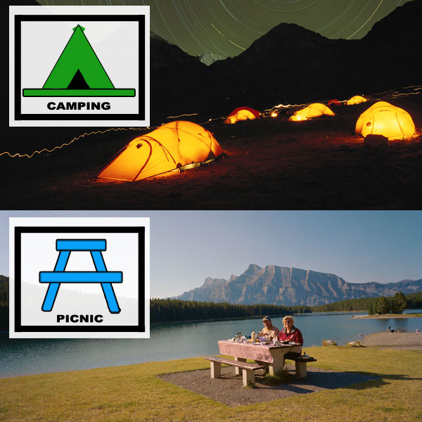
Image 1 – The familiar symbols for camping and picnic grounds
Not all symbols, however, have to look identical to what they are representing to be effective. If the same symbols are frequently used in the same way by different cartographers, they often become accepted as mapping conventions.
Through popular use, it has become a convention for certain colours to represent certain features. Aqueous (relating to water) landforms, including lakes and rivers, are almost always depicted on maps as blue in colour. Vegetation is often featured as green.
The use of size has also become a mapping convention. It is generally understood that the size of symbols, or the font size of labels, are linked with the importance or quantity of a feature on a map. Symbols used to denote settlements, for example, are often larger when representing places of a greater population.
See image 2
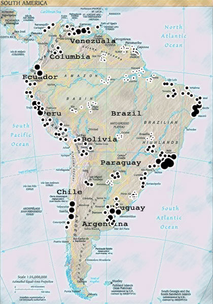
Image 2 – Example map
What is a legend?
While there are a number of map symbols which are easily identifiable with a corresponding feature in the real world, this is not always the case. Without a legend, the numbers and lines found on contour maps, for example, would be meaningless to someone who lacked an understanding of topography (study of the shape and elevation of the landscape). This is why maps need legends.
A legend (also known as a key) is a table which explains the meanings of signs, symbols, colours and abbreviations used on a corresponding map or chart. A legend features each symbol shown on the map, with a short description of its meaning. The legend is usually located at the bottom of the map, or somewhere close to the margin of the page.
In an atlas, it is not uncommon for the legend to encompass an entire page. A legend in an atlas is generally applicable to every map featured. It includes a wide range of symbols for boundaries, roads and railways, buildings, mines and caves, agriculture and vegetation, rocks and minerals, languages, religions, and industries. The legend is displayed towards the front of the atlas, where it will be read before the maps.
See image 3
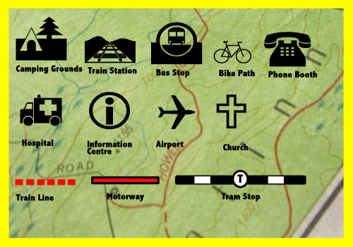
Image 3 – A map legend
Sumber : http://www.skwirk.com